USGS puts the Central California earthquake near Pinnacles at magnitude 5.0, down from first reports of 5.4
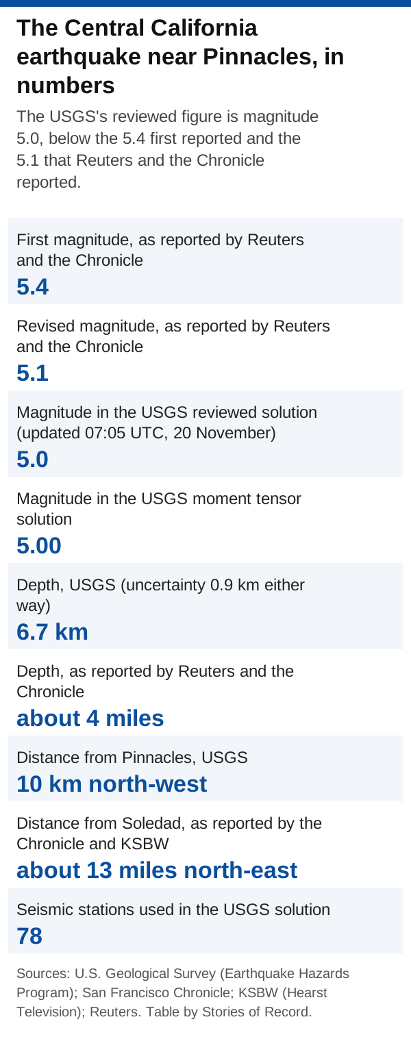
The USGS's reviewed solution gives magnitude 5.0 for the quake near Pinnacles National Park, below the 5.4 first reported and the 5.1 that Reuters and the Chronicle reported.
The earthquake that shook Central California late on 19 November measured magnitude 5.0, according to the reviewed solution of the U.S. Geological Survey (USGS). Early reports gave 5.4. Reuters and the San Francisco Chronicle then reported a revision to 5.1. The quake struck near Pinnacles National Park at 10:49 p.m. Pacific time, and the USGS puts its depth at 6.7 km.
Key facts
- An earthquake struck near Pinnacles National Park in Central California at 06:49 Coordinated Universal Time (UTC) on 20 November 2026, which was 10:49 p.m. Pacific time on 19 November. The USGS places it 10 km north-west of Pinnacles. The San Francisco Chronicle and KSBW reported it as about 13 miles north-east of Soledad. [1] [2] [3]
- The USGS's reviewed solution gives the quake a magnitude of 5.0 on the moment magnitude scale. Its event page labels this solution version 4, marks it as reviewed and shows it was last updated at 07:05 UTC on 20 November, which was 11:05 p.m. Pacific time the same night. The USGS's separate moment tensor solution, a calculation from the way the ground moved, also gives 5.00. [1] [5]
- The 5.1 that Reuters and the Chronicle reported is one tenth higher than the 5.0 now on the USGS event page. The USGS page is the source both outlets credit, so its reviewed figure is the one this page uses. [1] [4]
Timeline
- The USGS's reviewed solution gives the quake a magnitude of 5.0 on the moment magnitude scale. Its event page labels this solution version 4, marks it as reviewed and shows it was last updated at 07:05 UTC on 20 November, which was 11:05 p.m. Pacific time the same night. The USGS's separate moment tensor solution, a calculation from the way the ground moved, also gives 5.00. [1] [5]
- An earthquake struck near Pinnacles National Park in Central California at 06:49 Coordinated Universal Time (UTC) on 20 November 2026, which was 10:49 p.m. Pacific time on 19 November. The USGS places it 10 km north-west of Pinnacles. The San Francisco Chronicle and KSBW reported it as about 13 miles north-east of Soledad. [1] [2] [3]
What we know
- The USGS gives the depth as 6.7 km, with an uncertainty of 0.9 km either way. Reuters and the Chronicle reported a starting depth of about 4 miles below the surface. [1] [4] [2]
- The USGS lists the epicentre, the point on the surface above where the quake started, at 36.593 degrees north and 121.221 degrees west, within 0.3 km. Its solution draws on readings from 78 seismic stations. [1]
What we don't know yet
- The USGS first put the magnitude at 5.4, Reuters and the San Francisco Chronicle reported. The USGS event page we read shows only its current figure, so we could not see this first estimate ourselves. [4] [2]
- The USGS then lowered the figure to 5.1, according to Reuters and the Chronicle. Both outlets credit the number to the USGS, so this is one measurement relayed twice, not two independent confirmations. [4] [2]
Why it matters
If you searched for a 5.4 earthquake, that was the first figure, not the latest one. The USGS's own event page now shows 5.0. Reuters and the Chronicle both credit their figures to the USGS, so their 5.1 is one measurement passed on twice, not two separate checks. This page lists each figure, who gave it and where it came from.
Questions
How strong was the Central California earthquake?
Magnitude 5.0, according to the reviewed solution on the USGS event page, last updated at 07:05 UTC on 20 November (11:05 p.m. Pacific time on 19 November).
Why did I see 5.4?
That was the first figure. Reuters and the San Francisco Chronicle reported that the USGS first said 5.4 and then lowered it to 5.1.
Why do some reports say 5.1 when the USGS says 5.0?
Reuters and the Chronicle reported 5.1. The USGS event page we read on 20 November shows its reviewed figure of 5.0. We use the USGS figure, because both outlets credit the USGS.
Where was it, and how deep?
The USGS places it 10 km north-west of Pinnacles at a depth of 6.7 km. The Chronicle and KSBW reported it as about 13 miles north-east of Soledad, and Reuters and the Chronicle reported a depth of about 4 miles.
Do Reuters and the Chronicle confirm each other?
No. Both credit the USGS for their figures, so they pass on one set of measurements rather than checking it separately.
Where do these facts come from?
From the USGS event pages for this quake, read by us, and from Reuters, the San Francisco Chronicle and KSBW, cited from our news brief and not opened by us.
Updates
- First published.
Every version of this story, as first published.
Sources
- U.S. Geological Survey (Earthquake Hazards Program) Official (government)Retrieved: 20 November 2026
- San Francisco Chronicle News organizationPublished: 19 November 2026Reported by San Francisco Chronicle; credited as reported, not opened by us
- KSBW (Hearst Television) News organizationPublished: 19 November 2026Reported by KSBW (Hearst Television); credited as reported, not opened by us
- Reuters News organizationPublished: 20 November 2026Reported by Reuters; credited as reported, not opened by us
- U.S. Geological Survey (Earthquake Hazards Program) Official (government)Retrieved: 20 November 2026
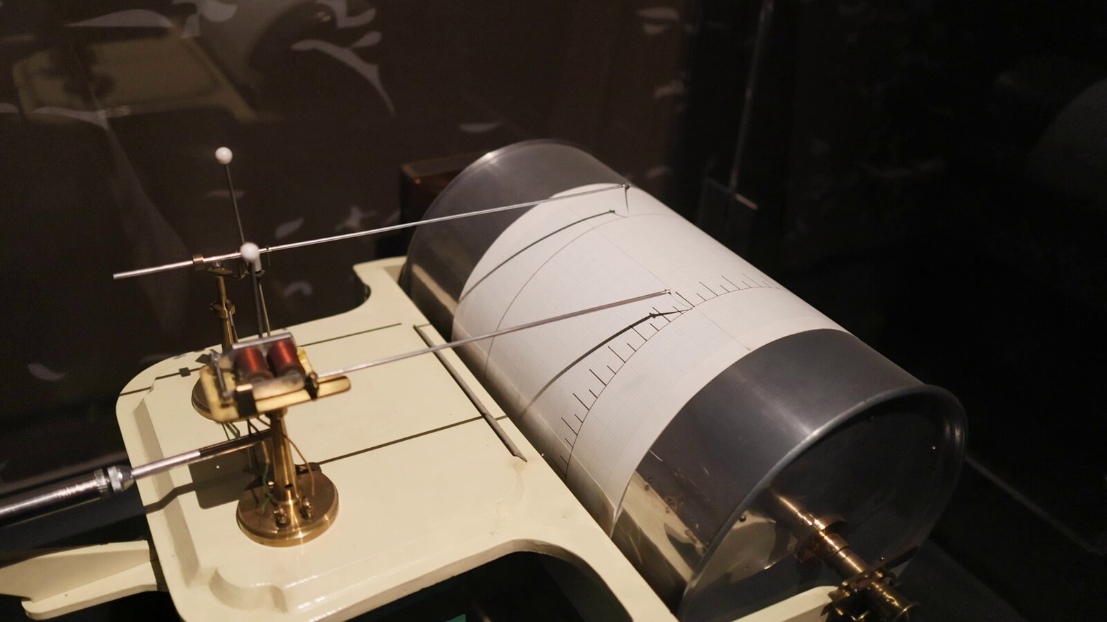
About the picture: this is a stock photo from Storyblocks. It does not show the people, places or events in this story.
People, places and organizations
- Organization
- U.S. Geological Survey
- Place
- Pinnacles National Park
- Place
- Soledad, California
Follow us on Facebook
We post new records on our Facebook Page.
Follow on Facebook